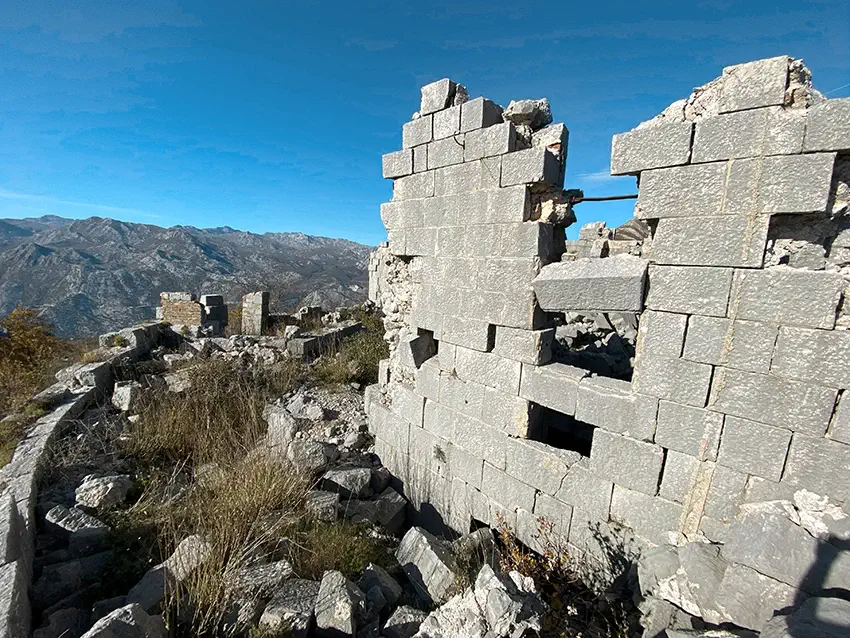
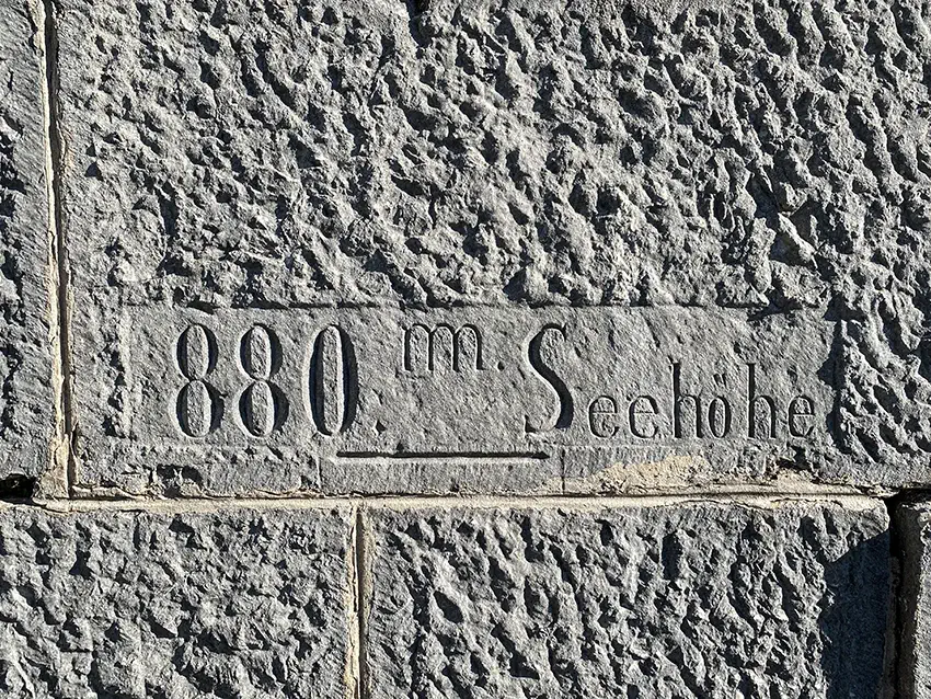
Fort Sanik (Serbian/Montenegrin Fort Šanik or Tvrђava Šanik) is a fortification built by the Austro-Hungarians in the late 19th century to control the mountain border in the Gornji Orahovac area. According to the builders' plan, the fortress, located at an altitude of 880 meters above sea level, was to block the passage through the mountainous terrain from Lovćen to the Bay of Kotor and Grahovo.


The construction site was not chosen by chance. For centuries, there have been mountain routes over the Bay of Kotor, which were often used by the Ottomans to bypass and encircle Perast. The Austro-Hungarian Empire, which acquired the area, widened the roads, created a water supply system and a number of fortifications along the mountain routes.

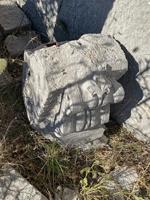
Description of Sanik Fortress
The fort was completed in 1883. It housed a garrison of 1 officer and 40 infantrymen. Their arsenal included small arms, machine guns and two M-04, 90mm howitzers.
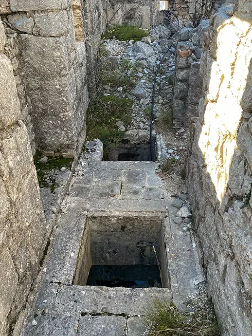
Like any Austrian fortress on the territory of Montenegro, Fort Sanik has its own water tank, which still supplies water to the inhabitants nearby. The building used to be three-storied: the ground floor had storage rooms, the first floor had soldiers' barracks, kitchen and showers, and the second floor had officers' quarters.


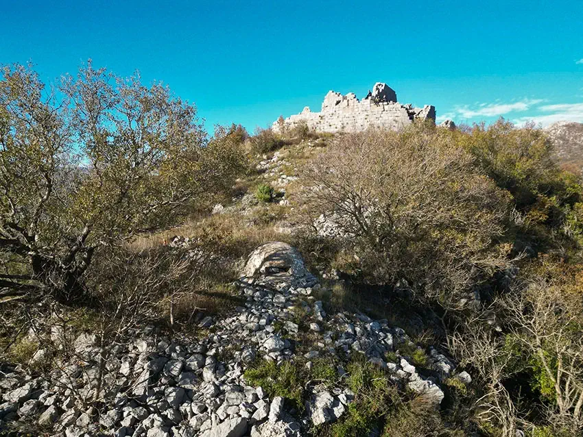
Fort Šanik has an excellent view. It overlooks Lovcen, another Austrian fortress Vranovo Brdo, Kotor, the remains of the Ježevići Barracks and endless mountain ranges.

On the approach to the fortification you can find a well and a concrete bunker that was once equipped with a machine gun. At the foot of the mountain are the remains of other Austrian buildings (warehouses, stables, bathhouses, bakery)
After more than 140 years, the fortress has lost its former grandeur and is now almost completely destroyed. The 1979 earthquake played a major role in this destruction.
How to get to Fort Sanik
Fortress Šanik is located in a mountainous area, but there are still at least 2 trails using which every lover of historical artifacts can visit it.
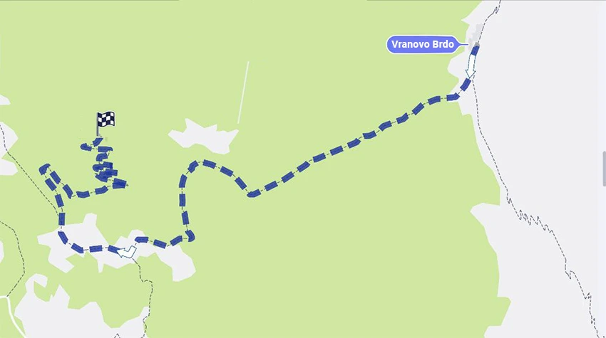
How to get to Fort Sanik from Perast
This is a more difficult route, but more historical. Initially you need to climb up to the Vranovo Brdo fortress (see here how to do it), and then walk from it to the Šanik fortress (2.6 km). It is worth noting that the road from Vranovo Brdo to Šanik is quite simple and easy, with no major drops in elevation and a flat road.
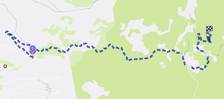
How to get to Fort Sanik from Risan
Ideally you should reach the Ledenice area above Risan by car. Most of the road has asphalt, although in poor condition. The asphalted road ends here:
After that, you can drive only by off-road vehicle or walk (5.6 km). This walk will come out much easier than the previous option and with beautiful views of the bay.