
Tajno Brdo is an area above Herceg Novi, near the settlement of Kameno. It literally translates as «Secret Hill». In addition to its mysterious name, the hill boasts the remains of an Austro-Hungarian and then Yugoslav military facility, which is now abandoned and accessible to the public.
It is 490 metres above sea level, offering a beautiful panorama of the surrounding area.

The Battle of Kotobil
One of the most frequent references to this area is related to the Battle of Kotobil. Then, on 15 September 1687, Venetians, Perastians (inhabitants of Perast), Herzegovinians, Montenegrins and other soldiers ambushed an Ottoman detachment. As a result of the battle, the Turkish troops were defeated. The Battle of Kotobil is believed to be the turning point before the liberation of Herceg Novi in 1688, after 300 years of Ottoman rule.
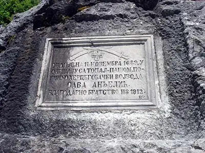
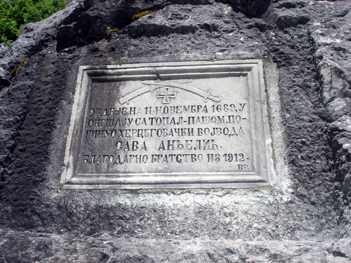
Later, in November 1689, another battle was fought here between the troops of the Herzegovinian governor Sava Anđelić and the Bosnian vizier Hussein Topal Pasha. Sava Anđelić was killed, but a memorial plaque was erected in 1912 to commemorate his valour.
Kameno outpost
In 1815, as a result of the Congress of Vienna, the Bay of Kotor was taken over by the Austro-Hungarian Empire. The Austrians immediately began to fortify their new territory, creating numerous fortifications throughout Boka and dividing it into three defence zones.
The entrance to the Bay of Kotor becomes the first defence zone, which includes part of Lustica, now the Croatian peninsula of Prevlaka, as well as the area from Herceg Novi to Kumbor.

In Herceg Novi, on the site of an old Turkish fortress Spanjola appears austrian fort (Fort Spagnuolo) with a battery (Kustenbatterie Spagnuolo), and near Kameno, on the Tajno Brdo mountain, the outpost Kameno (Stutzpunkt Kameno) was built in 1884. This fortification consists of several observation points, a water cistern and other buildings necessary for the soldiers to live comfortably.
This military facility had a wide view of the surrounding area and its location was so convenient that the fort was subsequently used until the late 1990s.
Today, it remains a landmark that can be visited by any willing tourist.

Grucalica (Gručalica)
Gručalica is a peak near Tajno Brdo, formerly used by the Yugoslav military. It is now a hill with the remains of concrete structures and a beautiful view of the entrance to the bay.
It can be climbed (about 180 metres) via a footpath that leads from the tarmac road below.

How to get to Tajno Brdo
The fortification at Tajno Brdo can be reached either by car or as part of an active walk from Herceg Novi. Let us consider each of the options.
How to get to Tajno Brdo on foot
There are several options for walking routes, depending on which part of the city you start from. On average, it is about 2.5 kilometres long. We recommend installing the free maps.me app to plot your optimal route. Unlike Google maps, in the application walking routes will have markings, which will allow you to lay them accurately. In addition, after downloading the map of the region, the application works without Internet.
It's worth noting that the road itself is quite easy and has 4 drinking springs along the way, which is a definite plus on hot days.
Among other things, this route allows you to walk across the 19th century Matković stone bridge (Matkovica most) and see the old spring of Zelenac.
How to get to Tajno Brdo by car
You can also get to the fortification by car. And you will only have to climb the last 300 metres on foot, which will take about 15-20 minutes of your time.
You can leave your car here and a signpost will show you the way.
